San Benito County is located in proximity to these regional transportation and shipping connections.
San Jose Int’l
Airport
50 miles
Port of Oakland
86 miles
Highway 5
38 miles
Highway 101
8 miles
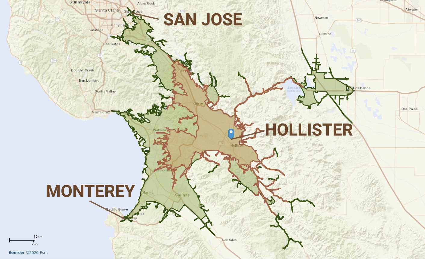
Workforce Commute Map
![]() 30-Minute Reverse Commute
30-Minute Reverse Commute
![]() 45-Minute Reverse Commute
45-Minute Reverse Commute
Available Labor Force – 2021

Note:
(a) The civilian population figures include only the population who are considered to be in the labor force. They exclude other residents who do not participate in the labor force for various reasons.
(b) Geographies include a 30 and 45-minute driving commute to the City of Hollister’s industrial area – more specifically from the intersection of San Felipe Road and Flynn Road. The driving commute analysis takes into consideration the typical traffic conditions on Monday at 8:15 a.m.
Sources: Esri Business Analyst; BAE, 2021.